Water & Wetlands
Geospatial Data
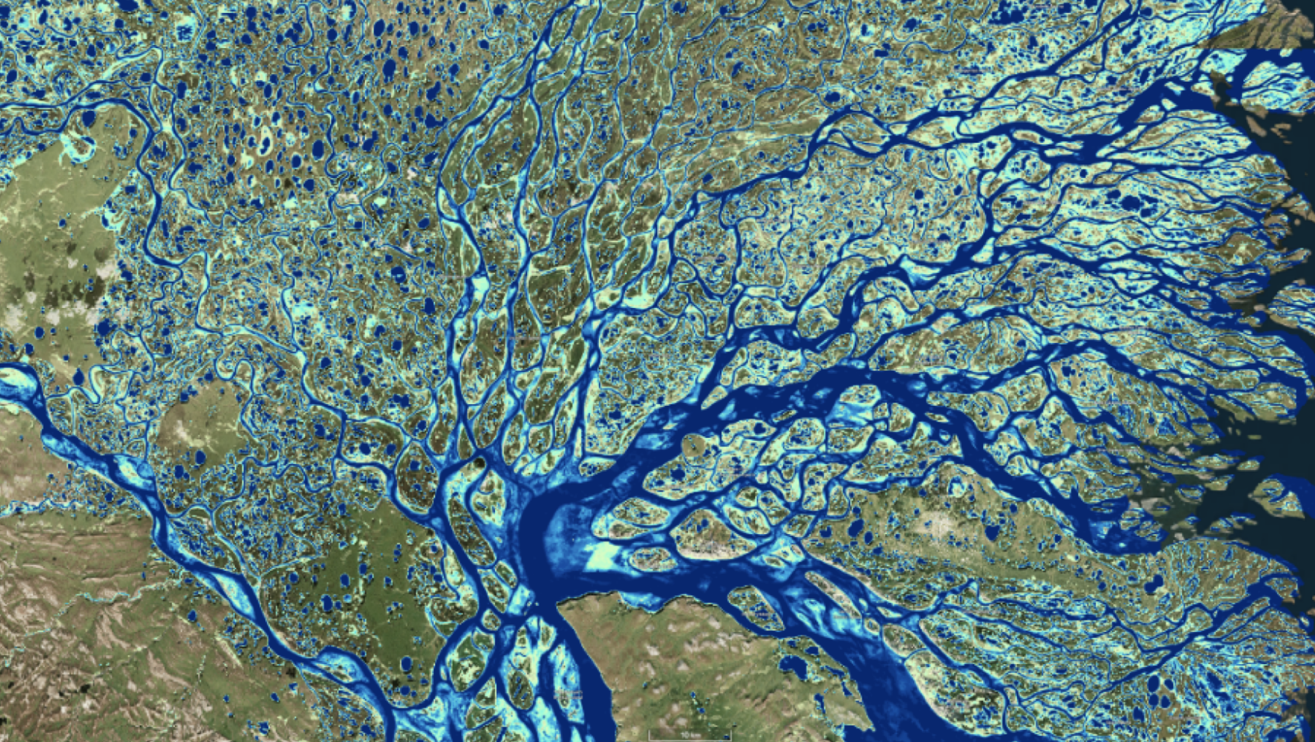
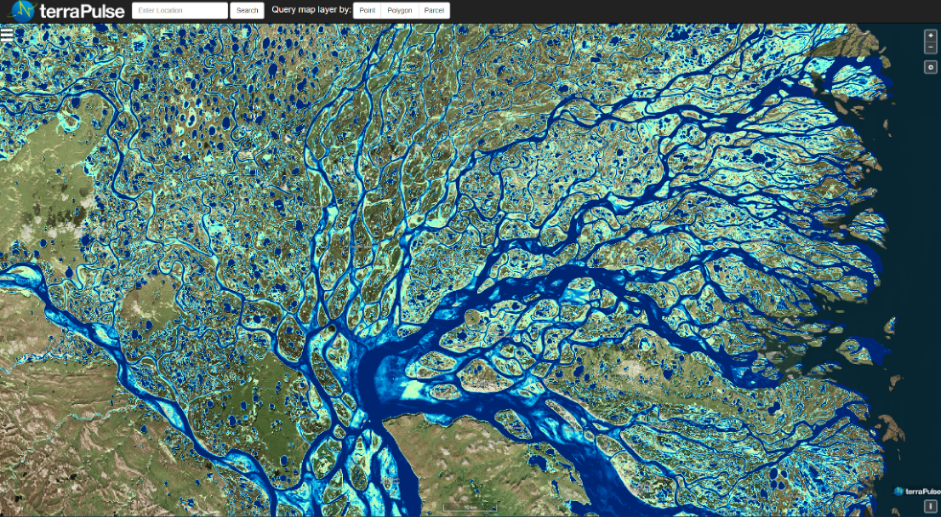
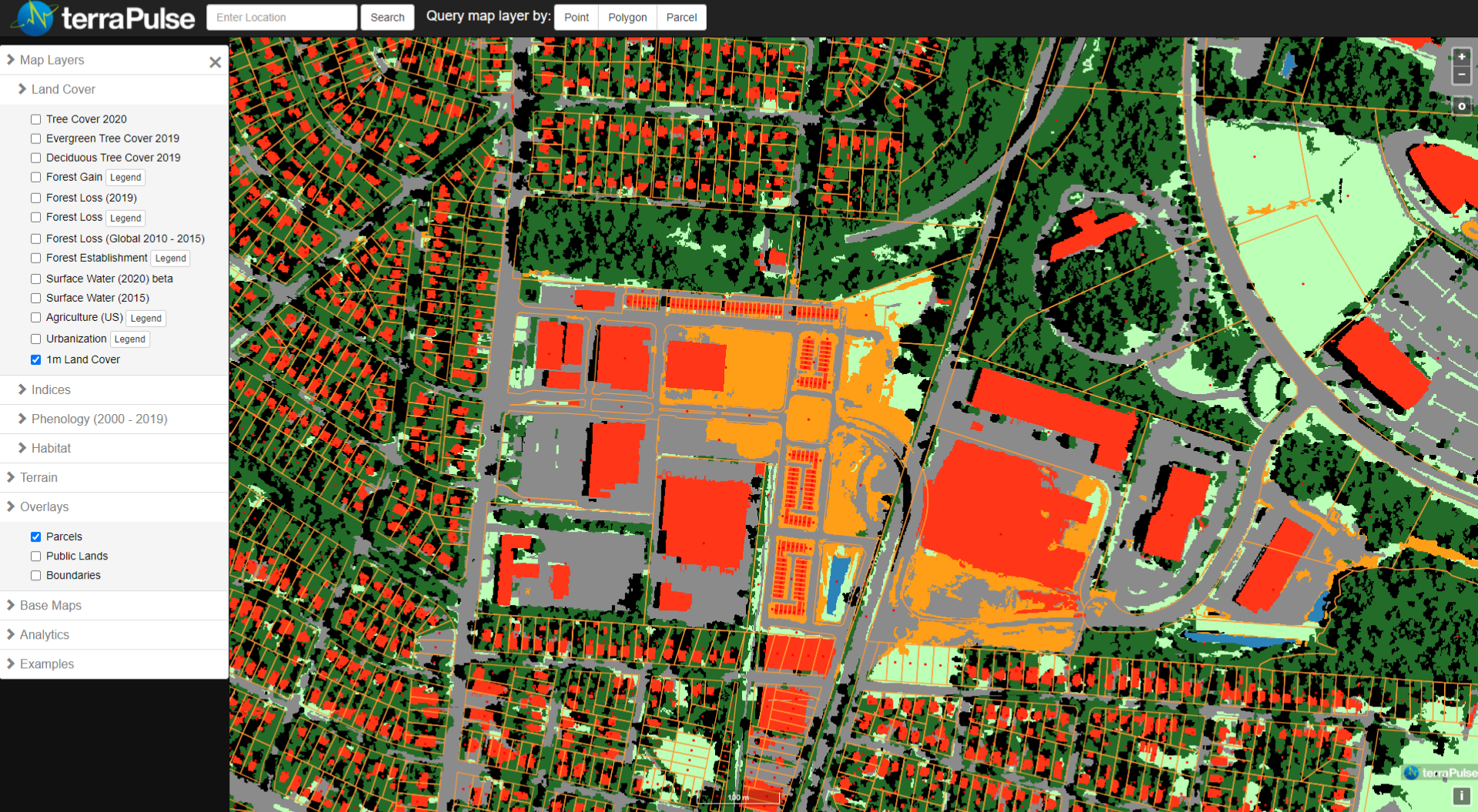
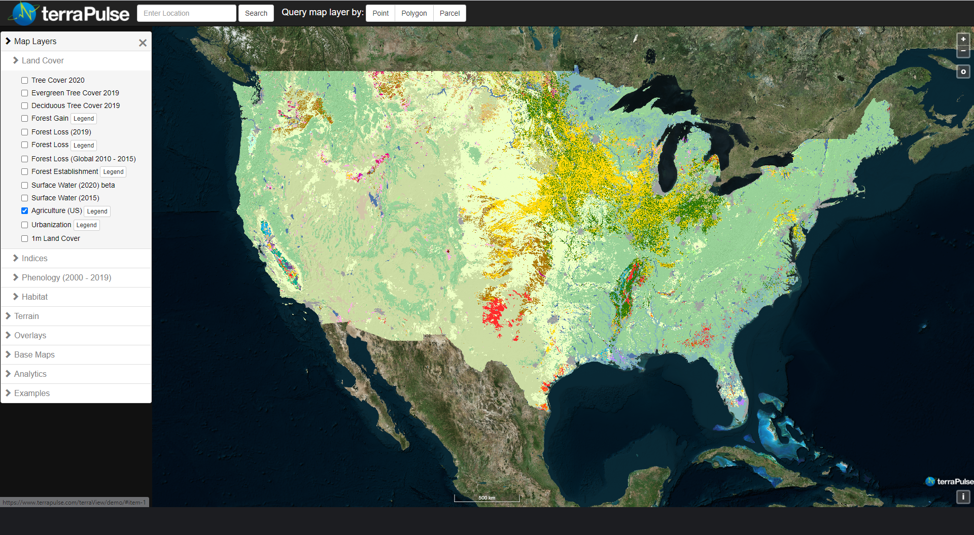
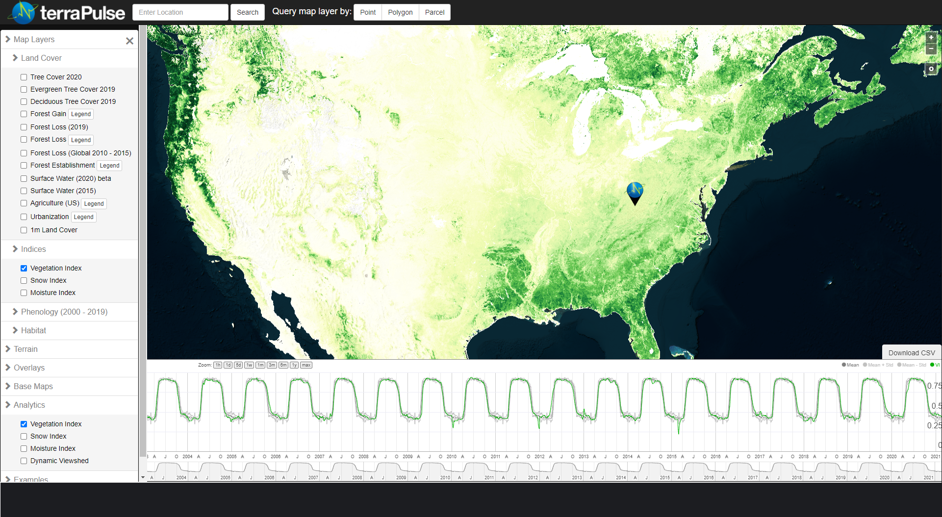
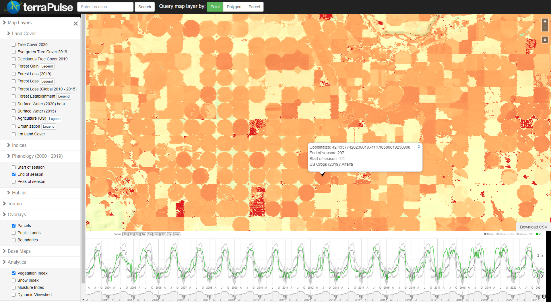
The spatial distribution of water and its changes over time indicate exposure to flood risk, detect aquaculture and paddy agriculture, and identify wetland habitats for waterfowl and other wildlife. The terraPulse suite of surface-water layers represent inundation of the ground surface of each pixel by water—either categorically at any point in time or probabilistically over longer intervals—and are available globally at 30-m resolution from 1984 to 2020. Through the terraPulse Land Cover Layer, the Surface Water layer is also available as a binary measurement at 1-meter resolution, with historical coverage depending on availability of high-resolution imagery.